San Andreas Fault, Part 6: San Bernardino
GALLERY: All San Andreas Fault photos in gallery format
After descending the mountains from Cajon Pass, the San Andreas Fault cuts through the northern edge of the San Bernardino metro area. The fault zone crosses hundreds of streets, washes, power lines and residential backyards. The straight-edged foot of the mountains marks the location of the fault trace, making it easy to locate visually.
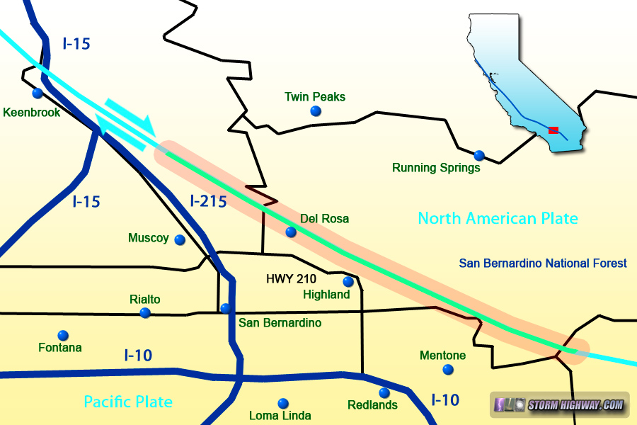
Map of this segment of the tour
San Bernardino, California
Here are a few examples of where the fault - quietly, for the moment - crosses below residential streets in the North Park, Del Rosa and Highland neighborhoods:
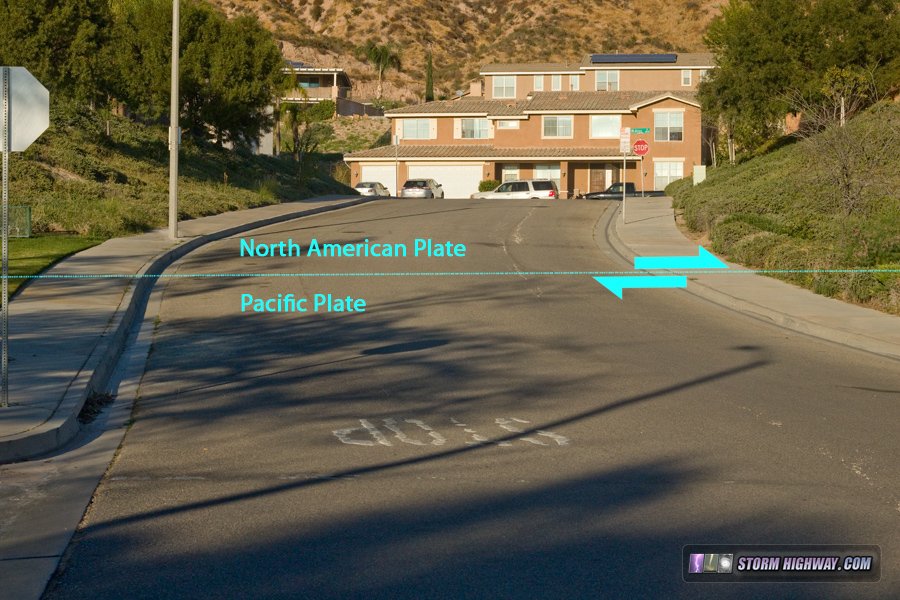
San Andreas Fault zone in San Bernardino, CA
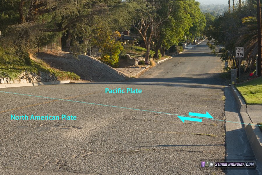
San Andreas Fault zone in San Bernardino, CA
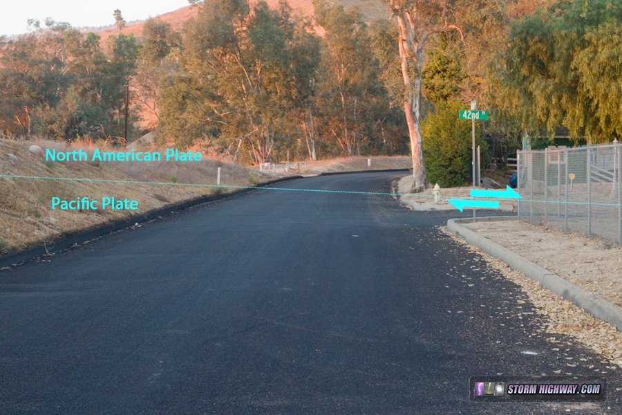
San Andreas Fault zone in San Bernardino, CA
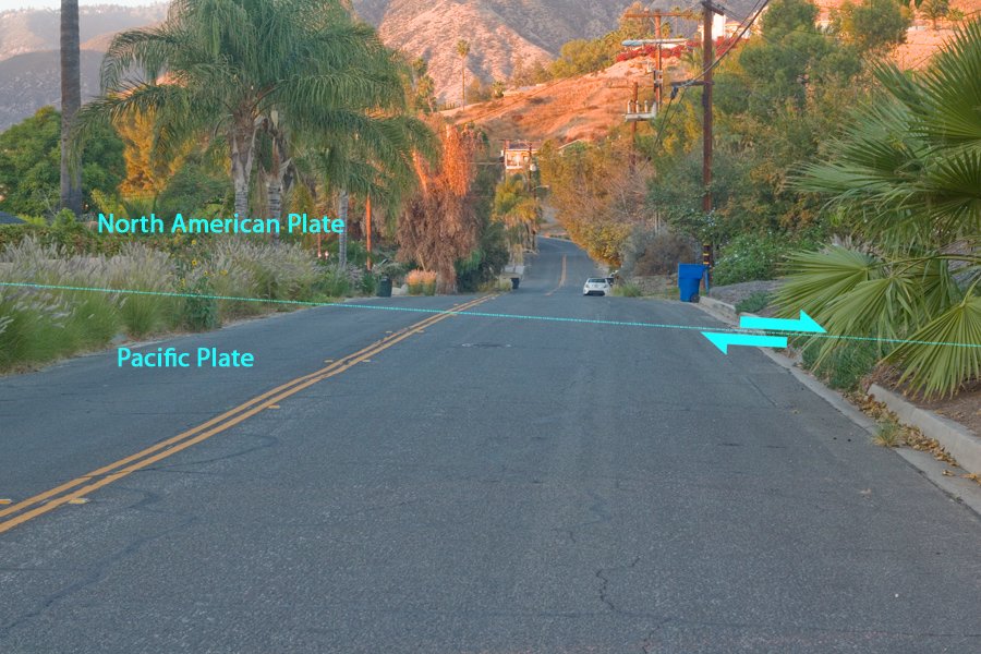
San Andreas Fault zone in San Bernardino, CA
The fault crosses the foothills near Greenspot Road:
click for larger version
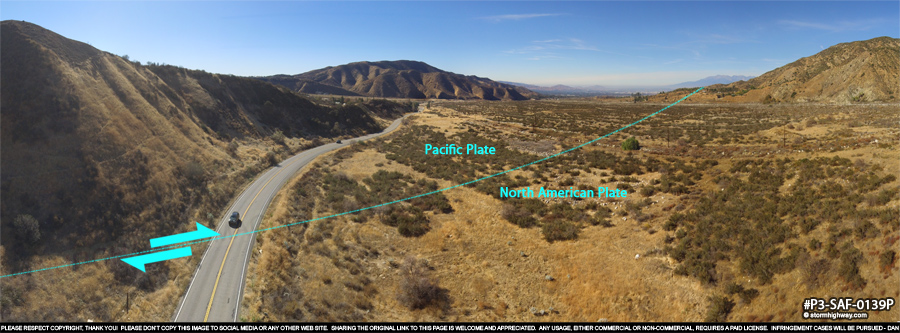
Mentone, California
On the northeastern edge of the metro, the fault crosses Mill Creek Road near the mouth of the canyon. This view looks southwest:
click for larger version
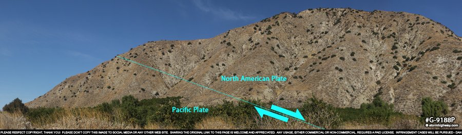
It is here that the fault begins traversing the San Bernandino Mountains among Little San Gorgonio Peak. There are no public non-4WD roads available to access to the fault trace in this stretch, so we'll jump on I-10 and head east around the mountains. As we do, we'll get a distant view of the fault zone in the high terrain: |