
|
||||||||||||||||||||||||||||||||||||
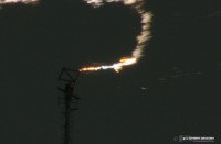
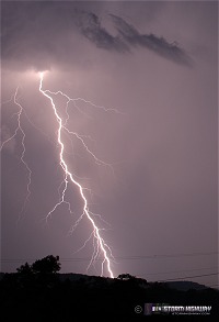
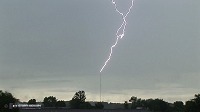
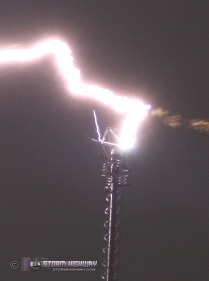
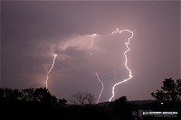
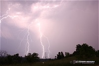
Click any thumbnail on this page to view a larger version. HD EXPEDITION VIDEO: Lightning hits tower 9 times, up close: Watch Video HD EXPEDITION VIDEO: Bow echo shelf cloud over Sissonville: Watch Video CHARLESTON, WV - Strong upper-level winds, ample surface moisture and lingering frontal and outflow boundaries brought strong thunderstorms to most of West Virginia on Tuesday and Wednesday, resulting in flooding, wind damage and spectacular lightning to the state. I was blessed with two days of great chasing (some of the best in over 15 years) and captured dozens of 'keeper' 12MP stills on my new Canon DSLR. Photographically speaking, the past two days have rivaled many of my Great Plains trips in quantity and quality of imagery obtained. With gas prices as high as they are now, it was great to get storms of this caliber without having to drive 1,000 miles from home! The event started with several rounds of afternoon storms on Tuesday, during which I spent at the WVAH tower site outside of St. Albans. I witnessed ten (10) direct hits to the tower in a 90-minute span, four of which I either entirely or partially captured on the DSLR at close range:
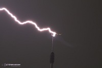 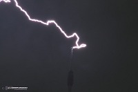 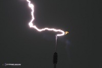
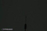
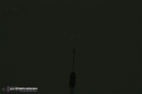
The full-size crops of the stills show fine detail you never normally get to see at the connection point of a lightning strike. Channel 'bead out' (dissipation), upward leaders and channel diameter are visible:
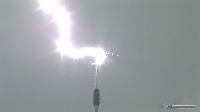
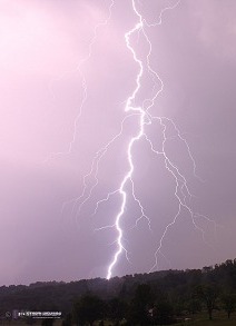
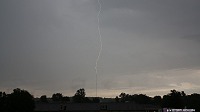
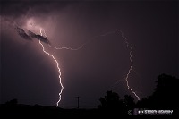
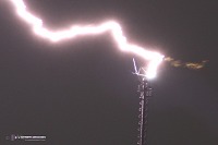  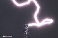 I also had my HD video camera rolling, and captured close-up high-definition footage of nine direct hits to the tower (watch HD video). Some of the strikes were unique, with numerous short leaders emanating from the tower tip. One bolt even bypassed the top of the tower to strike the side:
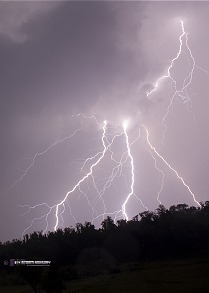
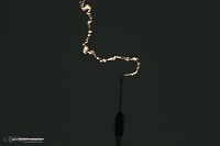
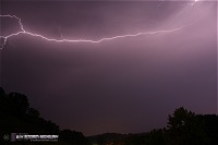
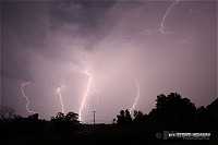
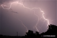
  That's two lightning myths 'busted' in a span of a few minutes: lightning never strikes the same place twice; and lightning always strikes the highest point! Later on Tuesday evening, more storms (some in the form of tornadic supercells) developed in Ohio and moved toward the state line. I drove up I-77 to Ravenswood to catch a series of at least 4 separate storms moving across the river into Jackson County. The lightning with these storms was frequent, brilliant and photogenic - top notch quality. I struggled to find a clear view, but managed to grab a good set of shots just north of Ravenswood:
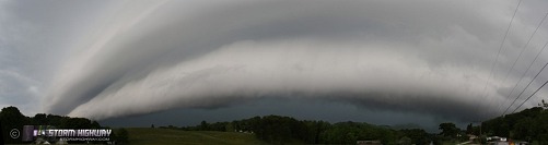
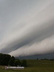
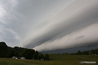
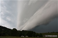
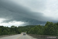
I arrived home at around 2AM with just a few hours of sleep before the event continued on Wednesday. I awoke in the morning to Charleston already in a tornado watch. By afternoon, storms were firing again. The orientation of the storms relative to the boundary suggested training and a flooding threat, so I initially focused on that angle. Eventually, a bow echo structure developed, and I drove to Sissonville to intercept the crest of the bow - expecting a nice shelf cloud. I was not disappointed! One of the most ominous shelf clouds I've seen quickly arrived from the west and charged overhead:
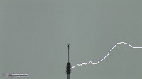
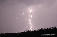
As the winds hit, power flickered on and off in Sissonville. I dove south back to Charleston quickly to escape the precip and possibly catch another shelf moving over Charleston, but the line had weakened over the city. With more cells moving in from the west, it was then on to St. Albans where I witnessed another two strikes to the WVAH tower (unfortunately I wasn't set up, and didn't get any images here). A third storm - an isolated supercell with a well-defined hook echo on radar - was racing south of Charleston toward Mahan on the turnpike, so I headed that way (This was the first time I'd taken all four interstate routes out of Charleston in a single day!) I thought that with the great instability, the storm would maintain itself, but it quickly fizzled before I got to Chelyan. After that, it was back home for a short break before yet another round of storms developing along a boundary out west. I headed to Teays Valley to wait for these to arrive, and while I did, a small cell passed over the WVAH tower to the south and started triggering upward strikes. I set up and got four of these (watch HD video), including one still of a dissipating strike.
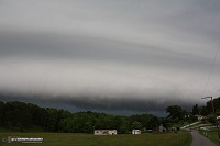
  The final cluster of storms was heading for Charleston, so I headed to Fort Hill to wait for it to pass over the city. As it arrived, a nice low shelf cloud moved in:
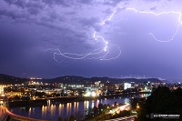
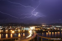
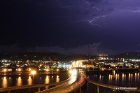
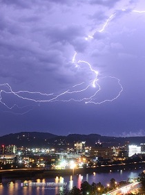
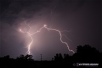
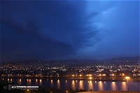 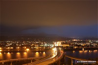 Shortly afterward, sky-filling anvil crawlers burst over the city, giving me another two shots I've always been trying for - lightning over the I-64 (Carter/Fort Hill/Oakwood) bridge, and lightning over downtown:
   After the third discharge, I decided to try for the 'hat trick' and get lightning over the Capitol. I quickly made my way to Greenbrier Street and set up west of the dome, but the storm was done producing lightning at that point - bringing the 36-hour 'chaseathon' to a close. Total mileage from this two-day event is a little under 200 - a half a tank of gas.
GO: Home | Storm Chase Logs | Photography | Extreme Weather Library | Stock Footage | Blog
Featured Weather Library Article:
|
||||||||||||||||||||||||||||||||||||


Web Site Design and Internet Marketing by CIS Internet